INTRODUCTION :
The
warming of sea surface temperatures in the tropical Pacific causes changes in
Pacific trade winds and ocean currents, setting off a chain reaction of weather
disturbances worldwide. Scientists believe that Bangladesh is one of the most
vulnerable countries in the world to El Niño or La Niña effects.[1] The country experienced very adverse El Niño
effects in 1997-98, which included
severe drought in various places and severe La Niña effects in 1998, which
included the most devastating floods.
It is thought that the country was also affected by the 1972-73, 1976,
1982, 1986 and 1994 El Niño events.[2] The
country's geographical location and climatic characteristics made it vulnerable
to such warm events.
The
present study has been designed mainly to assess El Niño impacts and response
strategies in Bangladesh and to depict the scientific views about their
teleconnections. Both primary and
secondary sources of data and information have been used for the study.
Relevant organizations like The Space Research and Remote Sensing Organisation
(SPARRSO), the Bangladesh Meteorological Department (BMD), The Disaster
Management Bureau (DMB), the Water and Power Development Authority (WAPDA),
concerned experts, and governmental/non-governmental officials have been
consulted. A seminar/workshop, comprising participants from concerned agencies
and from various government departments and non-governmental organizations, was
organized to incorporate a multi-dimensional approach to the study.
The
present report has been divided into five sections. Section-I deals with El
Niño/La Niña impacts in relation to
the country's geophysical & socio-economic settings, the existing
government mechanisms for dealing with the impacts of climate-related
disasters, and the country's level of scientific research on and historical
interest in El Niño. The flow of
meteorological information about the 1997-98 El Niño event, including the
transmission of El Niño information, media coverage, etc., has been depicted in
Section-II. El Niño teleconnections to various parts of the country area have
been scientifically analyzed and explained in Section-III. Section-IV deals
with the forecasting by analogy of El Niño/La Niña impacts. Section-V includes policy implications,
recommendations and conclusions.
1.1 GEOPHYSICAL AND
SOCIOECONOMIC SETTING
El
Niño (or La Niña) events do not affect all regions of the world with same
intensity. The vulnerability to El Niño effects depends upon the geographical
setting, whereas the intensity of impacts of the events depends upon both the
geographical and the socio-economic setting of a country.
1.1.1 Geophysical Features
Bangladesh
is a transition zone between Southwest and Southeast Asia. It forms the
capstone of the arch formed by the Bay of Bengal, and because of the Tibetan
plateau (massif) to the north, it is a comparatively narrow land bridge between
the sub-continent of India and sub-continent of Southeast Asia. More precisely,
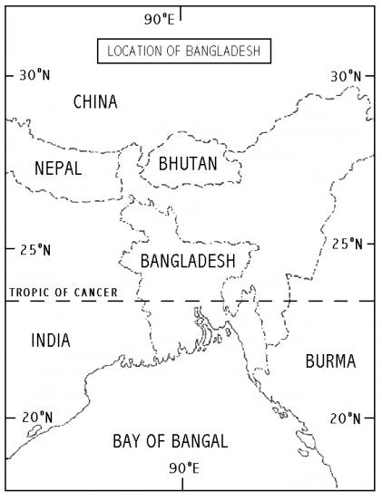
the country stretches latitudinally between 20° 34' N and 26° 33' N and longitudinally between 88° 01' E and 92° 41' E (Map 1). Some of
the biggest rivers of the world flow through the country and form the largest
delta in the world. The Ganges-Brahmaputra River system forms in the Bengal
Basin, a delta of 40,225 sq. km. in extent. It is, therefore, quite obvious
that the monsoon rains, the rise and fall of river levels, floods, alluvia and
dilluvia and changes in river courses form the substance of both the cultural
and physical geography of the area.
Geological
studies suggest that, due to continental drifts and plate tectonic movements,
the Gondwana part of the single continental mass Pangaea[3] underwent several changes through the
processes of subduction, collision and sea-floor spreading. In the Oligocene
Period (38 to 26 million years ago), some time after the plates collided, a
portion of the northern part of the Indian plate fractured and sank below sea
level. This portion was gradually filled up to form the eastern part of the
Bengal Basin (Map 2).[4] Bangladesh is, therefore, formed on a mass
of sediments washed down from the highlands on three sides of it, and
especially from the Himalayas, where slopes are steeper and the rocks less
consolidated. The greater part of this land-building process
must have been due to the Ganges and Brahmaputra Rivers. It is mainly a deltaic
land having hundreds of big and small rivers, Haors (large lake-like bodies), Baors,
Bils, etc., all over the country and
some hills and mountains in the northeastern, eastern and southeastern parts of
the country. The country has the longest continuous sea beach in the world
(about 144 km).
Map-1
Source:
Rashid, Harun Er.: Geography of Bangladesh.
University Press Ltd., Dhaka, 1991, p.2.
A
vast amount of water (1073 million acre feet/year)[5] flows through Bangladesh of which 870
million acre feet/year flows into the country from India. This brings about 1.5
billion metric tons of sediments into the country every year.[6] The
climate of the country is characterized by high temperature, heavy rainfall,
often-excessive humidity and a fairly marked seasonal variation (i.e., tropical
climate). The country is very rich in bio-diversity.[7] Due
to its geographical location, landforms and a funnel-shaped seashore,
Bangladesh is considered to be one of the most vulnerable disaster- prone
countries of the world.
1.1.2 Socio-economic features
 Bangladesh is an
agrarian country with 120 million inhabitants within an area of 143,999 sq. km.
of land. By religion, the country’s population consists of 86.6% Muslims, 12.1%
Hindus and 1.3% Christians and other cultural minorities. Nearly four-fifths of
the people depend, directly or indirectly, upon agriculture. The country's
agro-based production system depends mainly on climatic phenomena. High
population density, a rapid rate of population growth, low per-capita income
(only $273 US a year), mass poverty, low literacy rate, high rate of
unemployment, malnutrition (67% of the total population), weak economy, etc.,
are the major socio-economic features of the country.[8]
Bangladesh is an
agrarian country with 120 million inhabitants within an area of 143,999 sq. km.
of land. By religion, the country’s population consists of 86.6% Muslims, 12.1%
Hindus and 1.3% Christians and other cultural minorities. Nearly four-fifths of
the people depend, directly or indirectly, upon agriculture. The country's
agro-based production system depends mainly on climatic phenomena. High
population density, a rapid rate of population growth, low per-capita income
(only $273 US a year), mass poverty, low literacy rate, high rate of
unemployment, malnutrition (67% of the total population), weak economy, etc.,
are the major socio-economic features of the country.[8]
Many
of the people of the country have some deep-rooted religious superstition
regarding natural disasters. They believe that God imposes all disasters,
especially climatic disasters as a result of our outrageous activities.[9]
Map-2
Source:
Rashid, Harun Er: Geography of Bangladesh. University
Press Ltd., Dhaka, 1991, p.8.
1.1.3 Government Mechanisms
for Dealing with the Impacts of Climate-Related Disasters
To reduce the negative impacts of
climate-related disasters and minimize the sufferings of the people, the
Government has established a set of mechanisms including institutional
arrangements for disaster preparedness and relief and rehabilitation of the
area affected or potentially affected.
For making the established mechanisms appropriately and effectively
operative, an exhaustive guidebook entitled, Standing Orders on Disaster,
has been designed to outline the activities of each related ministry, division
and major agencies and departments.
Considering the importance of the effects of climate-related disasters
in Bangladesh, the government has also taken initiatives to formulate a
comprehensive National Policy of Disaster Management and a National Disaster
Management Plan. To deal with climate-related disasters by the entire
government machinery, the National Disaster Management Council meets the
requirement of clear policies and provides scope for proper implementation of
the policy directives. A High Level Inter-Ministerial Disaster Management
Coordination Committee gives decisions for implementation of these policies and
policy directives. The Committee incorporates the role of the Ministry of
Disaster Management and Relief as the responsible line Ministry, provides for
integration of the Armed Forces and reflects the crucial role of Disaster
Management Committees at Union, Thana and District levels. The
Bangladesh Cyclone Preparedness Program (CPP) has about 30,000 volunteers to
come to the rescue of the affected people in the coastal areas during cyclones.
The
Bangladesh Space Research and Remote Sensing Organization (SPARRSO) and the
Bangladesh Meteorological Department (BMD) are responsible for providing
forecast information about climate-related disasters in the country. The Bangladesh Water Development Board
(BWDB) is responsible for forecasting water-related disasters like floods and
their possible impacts.[10] These
organizations are also responsible for conducting research about
climate-related disasters and their effects on society and environment.
The
government media, Radio Bangladesh and Bangladesh Television, play the prime
role in transmitting the forecast information, tracking the courses and
chalking out elaborate programs on awareness development about preparedness and
the possible effects of potential disasters. The National Dailies also play a
vital role in these respects.
1.2 Climate-Related and Other Natural
Hazards Affecting the Country
During
the 1997-98 El Niño event, climate anomalies with significant socio-economic
impacts were experienced outside the tropical Pacific. El Niño-related natural
disasters are of global concern, have their most severe impacts on vulnerable
communities, and can contribute to increasing poverty.[11]
Bangladesh
is perhaps the only country in the world where casualties due to a cyclone
could rise into the hundreds of thousands. Floods can devastate more than half
the country causing damage in the billions of dollars. Nor'westers and
tornadoes often demolish the economy and settlements in many parts of the
country. Droughts destroy the country's food chain, food reserves and agro-based
production systems. A large number of households become homeless as a result of
riverbank erosion. Earthquakes cause severe damage to human settlements. The
climate-related and other natural disasters affecting the country have been
listed below in order of concern:
· Floods
· Tropical cyclones and
associated storm and tidal surge
· Nor'westers and
tornadoes
· Erosion
· Drought
· Earthquakes
· Siltation
· Salinity
·
Desertification
Scientists
have found a correlation between El Niño/La Niña events and the variability of
climatic phenomena in Bangladesh. They
have suggested that further research needs to be undertaken in this respect.
1.3 Level of Scientific Research on El Niño
El
Niño (or La Niña) has drawn worldwide attention very recently. The world’s experts
have differences of opinions regarding the origin and impacts of El Niño or (La
Niña) events. Walker and Bliss (1932) believed that the periodic warming and
cooling of the southern Pacific Ocean, which produces El Niño or La Niña
effects, is actually related to a phenomenon known as Southern Oscillation.
According to their view point, "when pressure is high in the Pacific
Ocean, it tends to be low in the Indian Ocean from Africa to Australia; these
conditions are associated with low temperatures in both these areas and
rainfall varies in the opposite direction to pressure. Conditions are related
differently in winter and summer, and it is therefore necessary to examine
separately the seasons of December to February and June through August.”[12] The Southern Oscillation is a seesaw
oscillation of pressure in the tropics between the Indian and the West Pacific
Oceans on one hand and the Southeast Pacific Ocean on the other. This is an
atmospheric phenomenon, whereas El Niño is an oceanic phenomenon.[13] Bjerknes considered it to be an event of ocean-atmospheric
coupling.[14] An
El Niño event is basically manifested by a reduction in coastal upwelling of
cold, deep ocean water to the surface.
Some scientists have argued that this quasiperiodic appearance of warm
surface water in the upwelling regions is triggered by various factors such as
continental drift, tectonic movement of ocean plates, earthquakes or volcanic
eruptions on the ocean’s bed. Greenhouse effects and global warming has also
been interpreted as triggering factors of El Niño or La Niña event.[15] Some scientists explained it to be a
combined effect of southeast trade winds, variations of sea surface
temperatures (SSTs) and Coriolis Forces.[16] Von
Humboldt (in 1802) presented his Peru-Current Theory, which is popularly known
as the Humboldt Theory, to explain the event. Klaus Wyrtki tried to explain the
phenomena with his Equatorial Kelvin Wave Theory.[17] Mark Cane stressed the importance of Rosby Wave Propagation from
the eastern to the western Pacific.[18] Numerical experiments are being carried out on a hierarchy of
coupled models of the atmosphere and the ocean and encouraging results have
been obtained toward El Niño predictions.
Many
scientists had previously speculated that El Niño was caused by disturbances
along the earth's crust, since earthquakes and volcanic eruptions often
preceded the phenomenon.[19] But
new work with computer models and sophisticated monitoring equipment suggests
that the current is not triggered by geological disruptions. Instead, it is part of a naturally occurring
cycle resulting in the interactions between the sea and the skies of the
equatorial Pacific. Scientists say that
the latest monitoring efforts have helped them make more reliable El Niño
predictions. Some scientists think that the decrease in tropical cyclone
numbers frequency and intensity in recent decades might be interpreted as
evidence that predictions of more and stronger cyclones accompanying warmer
SSTs are wrong.[20]
Scientific
research in Bangladesh relating to El Niño has not reached a satisfactory
level. Research on the issue is mostly conducted on individual
initiatives. The researchers use data
generated through both traditional and sophisticated methods by various
national and international meteorological agencies. In Bangladesh, studies have been conducted on "A
Climatological Study of Bangladesh and the Possible Correlation with El Niño/Southern
Oscillation" in 1993, "Bangladesh Floods, Cyclones and ENSO" in
1994, "Theory of El Niño" in 1994, "El Niño Southern Oscillation
and Rainfall Variation Over Bangladesh" in 1996, "ENSO and Monsoon
Rainfall Variation Over Bangladesh" in 1994, “El Niño and La Niña Cycle”
in 1998 etc., with individual initiatives. SPARRSO took up a research project
in 1999 entitled "Development of Models for Predicting Long Term Climate
Variability and Consequent Crop Production as Affected by El Niño-La Niña
Phenomena." Besides, several
studies have been conducted directly on the after effects of El Niño-La Niña
phenomena.
Through
these studies, scientists identified that the devastating flood of 1974 had
occurred due to the 1972 El Niño event, and the severe floods of 1987 and 1988
had occurred because of the 1986 El Niño event. They had predicted during the
1997 El Niño event that a La Niña situation could develop after May 1998 and
Bangladesh might experience severe flooding.[21] Scientific research found a negative
correlation with tropical cyclones over the Bay of Bengal and a correlation of
ENSO events with rainfall deficits over India and Bangladesh[22] during the 1951-87 period.
1.4 Historical Interests of
El Niño before the Onset of the 1997-98 El Niño Event
There
is no authentic historical record about when and how the first El Niño
occurred, but geologists assume that El Niño began occurring since the Tertiary
Period (2-65 million years ago).[23] Recorded historical evidence proves that the first El Niño event
occurred in 1925-26, although the term El Niño was not used in the record
(except in association with impacts in Peru). The term El Niño came into
worldwide use only recently. It is thought that El Niño has immense influences on monsoon climatic variability. Historical
evidence shows that monsoon phenomena have been under study on this
sub-continent since ancient times. For
example, monsoon phenomena have been mentioned in the holy Ramayana and
Mohabharata and in other Vedic books. In the book Artha-Sastra (Science of
Economics) written during the reign of Chandragupta Maurya (321-296 B. C.) by
his Minister Kautilaya, there is mention about the amount of rains at different
places, indicating that they had knowledge about rainfall measurements. The
astronomer Varaha Mihir (505-587 A. D.) used to predict rains. Astronomer Arya
Bhatta and Brahmagupta also studied the monsoon. The famous Sanskrit poet
Kalidas composed poems out of monsoon clouds as depicted in his Meghdoot
(Messenger of Cloud) and Ritusamahara (Cycle of Seasons). However, the real
credit for the meteorological and agro-meteorological predictions during the
ancient times goes to a mythical woman named Khana. Her verses are said to be
the envy of any scientist at any time. Scientifically Gilbert Walker, during
the time of British rule in India, identified effects of ENSO events in this
Sub-continent.[24] Sikka in 1980 was apparently the first to suggest that during El
Niño years the Indian monsoon performs below normal. Parthasarathy and Pant
observed in 1985 that the Indian monsoon shows a good correlation between a
strong SOI (cold event) and a good monsoon year.[25] Mandal conducted a study in 1989 on the relationship between
tropical cyclones and rainfall over the Bay of Bengal and ENSO events. Chowdhury
also conducted the same type of study in 1992. Ahmed in 1993 predicted that in
general the Bangladesh monsoon shows a decrease in rainfall in El Niño years in
all seasons.[26]
Today,
experts opine that the ability to accurately predict the coming of El Niño
could have a considerable impact on human development. After a scientific
study, ERFEN (Estudio Regional del Fenómeno de El Niño) experts say, "By
tracking ocean temperature, salinity levels and wind patterns, they can now
tell when El Niño is approaching several months before it hits South
America.” National Center for
Atmospheric Research (NCAR) Senior Scientist Michael Glantz says, "If you
can forecast El Niño, you can shed light on when to expect droughts and floods
in various countries."[27] Khana, Ghagh, Varaha Mihir, Ahamika Duck,
and Bhandori, etc., the most famous mythical persons in this sub-continent,
told of these conditions 3-14 centuries ago.
They did not utter the words El Niño or La Niña in their sayings, but
they rightly predicted the phenomena.[28] Khana's sayings are especially considered to be the most
important, most scientific and most talked about mythical worlds in Bangladesh
and also in this region. Some of her sayings have been quoted and analyzed as
follows:
Basically,
Khana's sayings are based on astronomical readings. She did not correlate her
forecasts to events like El Niño or La Niña episodes. Most of her
meteorological readings seem to be very much based on local weather. But
today's scientists found strong correlations between El Niño and La Niña
episodes and local climatic behavioral patterns.[29] What she told many centuries ago during the 9th lunar day of the
bright fortnight in the Bengali month of Ashar (June-July), “If the month of
Choitra (March-April) of a year experiences cold weather and the month of
Baishakh (April-May) is marked by storms and hailstorms and the sky remains
free from clouds, the year will receive sufficient rains; if rainfall is
torrential, the year may experience drought; if rainfall is intermittent, the
year may experience heavy flooding; if moderate rainfall occurs, crops will
grow in abundance and if the sky remains clear and bright during sunset on that
day, the year will experience salvation." Today's experts
have found scientific bases behind these predictions. She also predicted that:
If southwest monsoon winds blow at the beginning
of the year, the year will be marked by sufficient rainfall.
It
means that when the southwest wind blows from the Bay of Bengal, it carries a
lot of moisture and, as a result, plenty of rainfall occurs in summer (the
beginning of the year). Khana also predicted these climatic phenomena in
another way. Khana's predictions about
drought were the following:
If southern winds blow during rains, the rain will
stop and flood will decrease.
Bhandori,
another mythical person of this sub-continent predicted as follows: “If Southwest winds blow for seven days
continuously, the country will experience severe drought.” But Khana's
forecasts directly about drought were as follows:
If the sky remains cloudy during the day and
clear at night, the country will experience drought.
If hot weather in the month of Poush
(December-January) and cold weather in the month of Baishakh (April-May)
prevail and heavy rainfall occurs at the beginning of the month of Ashar
(June-July), the months Shraban-Bhadra (July-September) will experience drought
in that year.
Khana
had very peculiar insights about the duration of rainfall in different seasons
of the year. According to her:
If it is foggy during the month of Poush
(December-January), there will be rain in the month of Baishakh (April-May) for
the days exactly corresponding to the number of foggy days in Poush; if rain begins
on Saturday, it will continue up to seven days; if it begins on Tuesday, it
will continue up to three days.
Varaha Mihir also
predicted these climatic phenomena in a different way: “If the month of Poush
(December-January) does not experience excessive cold weather, the year will
receive sufficient rains.” According to
Khana, "by observing the weather of the month of Poush (December-January),
the weather of the whole year can be predicted. The weather condition of the
first two and a half days of the month of Poush (December-January) is the
indicator of every month of the next year.” She had devised a process of
predicting a weather calendar, which, today, is considered to be very much
scientific in nature.[30]
Some other predictions
of Khana about floods, rains and agricultural production were as follows:
If Northern wind blows
during the month of Shraban (July-August), the year will experience severe
floods.
If rain occurs in the month of Choitra (March-April) and cold
weather prevails in the month of Baishakh (April-May) in a year, scarce
rainfall will occur in the new year.
The more the mangoes grow, the more the floods
will occur; the more the jack-fruits grow in a year, the more the paddy will
grow in that year.
It
is true that the scientists on this sub-continent did not correlate the
climatic phenomena to named events like El Niño or La Niña historically, but
they predicted and recorded them. These
days, scientists are well-equipped with modern tools and technologies to
predict future events and trace out the correlations of past events. It is
remarkable that the great Bengal famine years of 1770, 1940-41, 1943 and 1974
were El Niño years.